
Get to know me
Hi, I’m Frank — a seasoned IT professional with over 20 years of experience at companies like Expedia, Hotwire, Nvidia, HortonWorks, Cloudera, and Afterpay. Alongside my tech career, I’ve always had a deep passion for RC models, robotics, and drones (and yes, food too—but no blog for that yet!). What began as a childhood fascination with remote-controlled models has evolved into a full-fledged commitment to professional drone services. Based in the San Francisco Bay Area, I proudly serve clients locally and beyond, delivering aerial insights through cutting-edge drone technology.
THE DIFFERENCE, MY NAME IS ON THE LINE
Unlike those who may have picked up a drone as a holiday gift or an impulse buy, I actively sought out this craft. I purchased my first intelligent drone and began flying recreationally in April 2000—long before drones were mainstream. Since then, I’ve earned my FAA Part 107 certification, allowing me to legally perform commercial drone operations.
Over time, I’ve invested in advanced equipment, including DJI’s Enterprise Matrice series and a suite of high-end software tools to expand my capabilities. I’ve dedicated myself to continuous training and professional development—both in flight and software proficiency—to ensure I deliver professional, reliable aerial data services.
I’m fully insured, FAA-compliant, and mission-ready. Let’s talk about how I can integrate drone services into your workflow to support your project goals. I look forward to helping you capture the data that moves your business forward.
-Frank Caballero
Mission
My mission is to empower clients with accurate, reliable, and innovative drone-based aerial data solutions. I deliver high-resolution imagery, precise geospatial intelligence, and advanced 3D modeling to support smarter decisions, enhance safety, and streamline workflows in construction, inspection, and mapping. Through expert piloting and cutting-edge technology, I’m committed to raising the bar for accuracy, transparency, and operational excellence.
Vision
My vision is to help lead the transformation of how industries capture and utilize aerial data—demonstrating that drone-powered solutions set a new benchmark for accuracy, efficiency, and innovation. I strive to shape a future where aerial intelligence plays a vital role in building smarter cities, safer infrastructure, and more sustainable projects.
Frank Caballero
Pilot
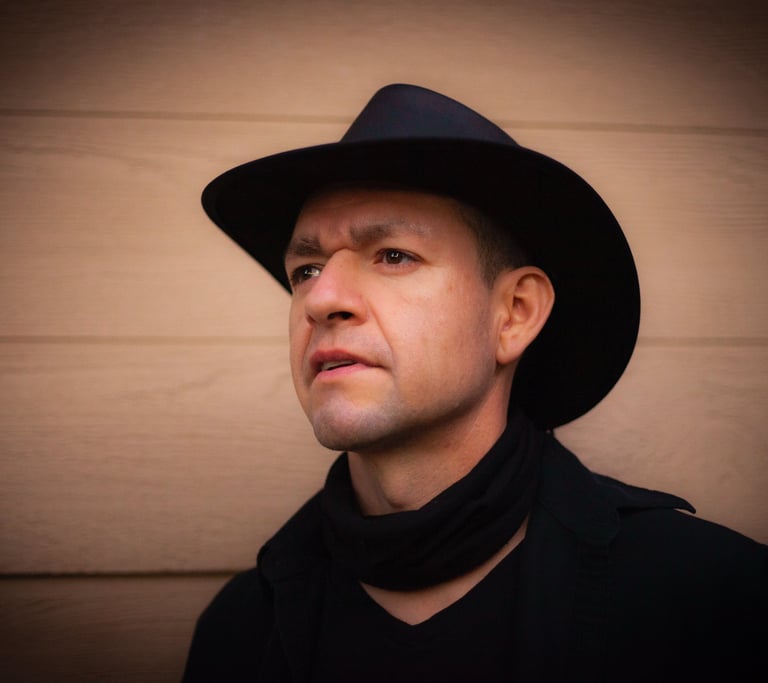
FAA-certified and insured UAV/UAS (drone) pilot specializing in aerial photography, data acquisition, and advanced mapping solutions for a wide range of industries and applications. proudly serving the Bay Area and beyond.
Your Trusted Drone Pilot
Contact me for a consultation and a custom solution tailored to your needs.
Or Leave your details, I'll give you a call:
frank@frankcaballero.com
© 2025. Drone Operator. All rights reserved.